
El Pedregal topographic map
Interactive map
Click on the map to display elevation.
About this map
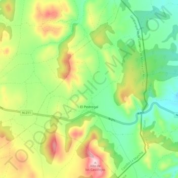
Name: El Pedregal topographic map, elevation, terrain.
Location: El Pedregal, Guadalajara, Castilla-La Mancha, 19327, España (40.75008 -1.60095 40.82348 -1.53924)
Average elevation: 4,032 ft
Minimum elevation: 3,599 ft
Maximum elevation: 4,731 ft