
Mabatang topographic map
Interactive map
Click on the map to display elevation.
About this map
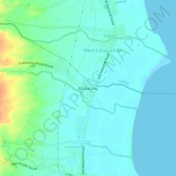
Name: Mabatang topographic map, elevation, terrain.
Location: Mabatang, Bataan, Central Luzon, 2114, Philippines (14.72195 120.51651 14.76195 120.55651)
Average elevation: 30 ft
Minimum elevation: -3 ft
Maximum elevation: 138 ft