
Kharun River topographic map
Interactive map
Click on the map to display elevation.
About this map
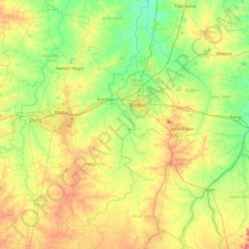
Name: Kharun River topographic map, elevation, terrain.
Location: Kharun River, Raipur, Chhattisgarh, 493332, India (20.77717 81.43134 21.56844 81.66942)
Average elevation: 958 ft
Minimum elevation: 833 ft
Maximum elevation: 1,194 ft
Other topographic maps
Click on a map to view its topography, its elevation and its terrain.
Mowa Talab
India > Chhattisgarh > Raipur
Mowa Talab, NH130B, Green Orchid, Raipur, Raipur Tahsil, Raipur, Chhattisgarh, 493332, India
Average elevation: 919 ft