
Prados del Sur topographic map
Interactive map
Click on the map to display elevation.
About this map
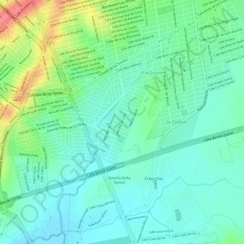
Name: Prados del Sur topographic map, elevation, terrain.
Location: Prados del Sur, Culiacán, Sinaloa, 80296, México (24.74770 -107.38299 24.75710 -107.37687)
Average elevation: 236 ft
Minimum elevation: 157 ft
Maximum elevation: 404 ft
Other topographic maps
Click on a map to view its topography, its elevation and its terrain.