
Thank you for supporting this site ❤️
Make a donation
Make a donation
Gear up for your next adventure:
As an Amazon Associate, this site earns from qualifying purchases at no extra cost to you.
Bankura topographic map
Click on the map to display elevation.
Thank you for supporting this site ❤️
Make a donation
Make a donation
Gear up for your next adventure:
As an Amazon Associate, this site earns from qualifying purchases at no extra cost to you.
About this map
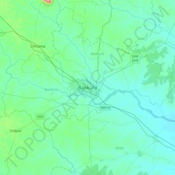
Name: Bankura topographic map, elevation, terrain.
Location: Bankura, Bankura - I, Bankura, West Bengal, 722101, India (23.07560 86.90602 23.39560 87.22602)
Average elevation: 338 ft
Minimum elevation: 187 ft
Maximum elevation: 1,394 ft
Thank you for supporting this site ❤️
Make a donation
Make a donation
Gear up for your next adventure:
As an Amazon Associate, this site earns from qualifying purchases at no extra cost to you.