
Okanogan River topographic map
Interactive map
Click on the map to display elevation.
About this map
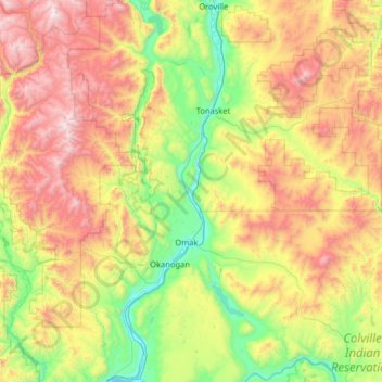
Name: Okanogan River topographic map, elevation, terrain.
Location: Okanogan River, Okanogan County, Washington, 98841, USA (48.09621 -119.73896 48.95070 -119.40266)
Average elevation: 3,297 ft
Minimum elevation: 771 ft
Maximum elevation: 8,179 ft
Other topographic maps
Click on a map to view its topography, its elevation and its terrain.
Molson Lake
USA > Washington > Okanogan County > Molson
Molson Lake, Nine Mile Road, Molson, Okanogan County, Washington, USA
Average elevation: 3,839 ft