
Vissoul topographic map
Interactive map
Click on the map to display elevation.
About this map
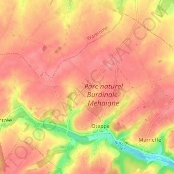
Name: Vissoul topographic map, elevation, terrain.
Location: Vissoul, Oteppe, Burdinne, Huy, Liège, Wallonie, 4210, Belgique (50.57128 5.10212 50.61128 5.14212)
Average elevation: 522 ft
Minimum elevation: 348 ft
Maximum elevation: 591 ft