
Larbaa topographic map
Interactive map
Click on the map to display elevation.
About this map
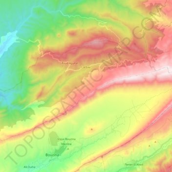
Name: Larbaa topographic map, elevation, terrain.
Location: Larbaa, Daïra Bouzina, Batna, Algérie (35.27580 6.01325 35.39464 6.22828)
Average elevation: 4,879 ft
Minimum elevation: 3,199 ft
Maximum elevation: 6,955 ft