
Canterbury topographic map
Interactive map
Click on the map to display elevation.
About this map
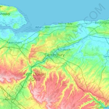
Name: Canterbury topographic map, elevation, terrain.
Average elevation: 164 ft
Minimum elevation: -7 ft
Maximum elevation: 630 ft
Other topographic maps
Click on a map to view its topography, its elevation and its terrain.
Shalmsford Street
Vereinigtes Königreich > England > Kent > Canterbury
Shalmsford Street, Canterbury, Kent, England, CT4 7LQ, Vereinigtes Königreich
Average elevation: 177 ft