
Plage Merkala topographic map
Interactive map
Click on the map to display elevation.
About this map
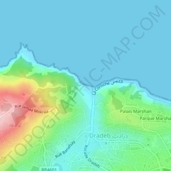
Name: Plage Merkala topographic map, elevation, terrain.
Average elevation: 141 ft
Minimum elevation: 0 ft
Maximum elevation: 719 ft
Other topographic maps
Click on a map to view its topography, its elevation and its terrain.
Parc Perdicaris
Maroc > pachalik de Tanger > Tanger
Parc Perdicaris, Tanger, Pachalik de Tanger, Préfecture de Tanger-Assilah, Tanger-Tétouan-Al Hoceïma, Maroc
Average elevation: 285 ft