Geolocate

Bandar Baru Salak Tinggi topographic map

Click on the map to display elevation.

About this map

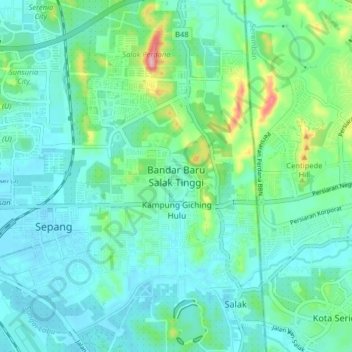
Name: Bandar Baru Salak Tinggi topographic map, elevation, terrain.

Location: Bandar Baru Salak Tinggi, Sepang, Selangor, 43900, Malaysia (2.77234 101.69728 2.85234 101.77728)

Average elevation: 118 ft

Minimum elevation: 7 ft

Maximum elevation: 561 ft

Other topographic maps

Click on a map to view its topography, its elevation and its terrain.

Sungai Sepang

Malaysia > Selangor > Sepang

Average elevation: 26 ft

Cyberjaya

Malaysia > Selangor > Sepang

Average elevation: 79 ft

Bagan Lalang Beach

Malaysia > Selangor > Sepang > Bagan Lalang

Average elevation: 7 ft

Cyberjaya Lake Park

Malaysia > Selangor > Sepang > Cyberjaya

Average elevation: 59 ft

Sungai Jenderam

Malaysia > Selangor > Sepang > Jenderam

Average elevation: 151 ft

Obama Oval

Malaysia > Selangor > Sepang > Cyberjaya

Average elevation: 98 ft

Cyberjaya

Malaysia > Selangor > Sepang

Average elevation: 79 ft

Sungai Labu

Malaysia > Selangor > Sepang

Average elevation: 62 ft

Sungai Salak

Malaysia > Selangor > Sepang

Average elevation: 85 ft

Putra Prima Playground

Malaysia > Selangor > Sepang

Average elevation: 23 ft

Apartment Taman Topaz Woods

Malaysia > Selangor > Sepang

Average elevation: 30 ft

Gear up for your next adventure:

🌎3D Topographic Globes - Raised relief globes for a tactile understanding of geography
💧Water Filtration Bottles - Safely drink from streams and lakes while exploring
🧭Pro Hiking Compasses - High-accuracy liquid-filled compasses for topographic orientation
🛌Ultralight Sleeping Bags - Compact down bags for cold nights in the wilderness
🎒Day Hiking Backpack - Lightweight backpack perfect for day trips and outdoor adventures

As an Amazon Associate, this site earns from qualifying purchases at no extra cost to you.