
Thrikkovilvattom topographic map
Interactive map
Click on the map to display elevation.
About this map
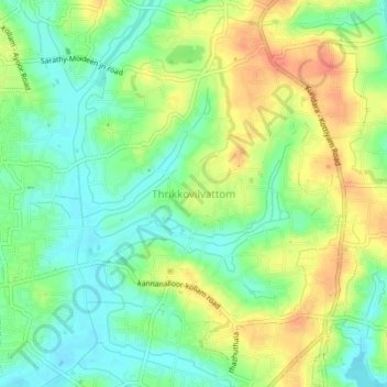
Name: Thrikkovilvattom topographic map, elevation, terrain.
Location: Thrikkovilvattom, Kollam, Kerala, 691577, India (8.88673 76.64724 8.92673 76.68724)
Average elevation: 75 ft
Minimum elevation: 7 ft
Maximum elevation: 161 ft