Fouvent-le-Bas topographic map
Interactive map
Click on the map to display elevation.
About this map
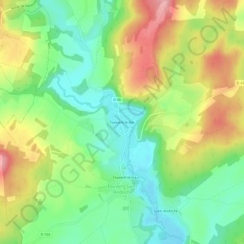
Name: Fouvent-le-Bas topographic map, elevation, terrain.
Average elevation: 883 ft
Minimum elevation: 699 ft
Maximum elevation: 1,138 ft

Click on the map to display elevation.
Name: Fouvent-le-Bas topographic map, elevation, terrain.
Average elevation: 883 ft
Minimum elevation: 699 ft
Maximum elevation: 1,138 ft