
Pardis topographic map
Interactive map
Click on the map to display elevation.
About this map
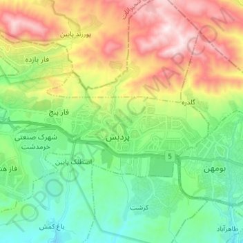
Name: Pardis topographic map, elevation, terrain.
Average elevation: 6,270 ft
Minimum elevation: 5,108 ft
Maximum elevation: 8,353 ft
Other topographic maps
Click on a map to view its topography, its elevation and its terrain.
کوه تخت چنار
Iran > Pardis County > Saidabad RD
کوه تخت چنار, Saidabad RD, Jajrud District, Pardis County, Tehran Province, Iran
Average elevation: 4,885 ft