
Bad Lausick topographic map
Interactive map
Click on the map to display elevation.
About this map
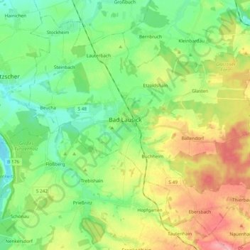
Name: Bad Lausick topographic map, elevation, terrain.
Location: Bad Lausick, Landkreis Leipzig, Saksen, 04651, Duitsland (51.08993 12.56655 51.19310 12.75396)
Average elevation: 597 ft
Minimum elevation: 459 ft
Maximum elevation: 840 ft