
山丹县 topographic map
Interactive map
Click on the map to display elevation.
About this map
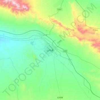
Name: 山丹县 topographic map, elevation, terrain.
Location: 山丹县, 张掖市, 甘肃省, 734100, 中国 (38.62344 100.93081 38.94344 101.25081)
Average elevation: 6,493 ft
Minimum elevation: 5,390 ft
Maximum elevation: 10,157 ft
Other topographic maps
Click on a map to view its topography, its elevation and its terrain.