
Town of Salina topographic map
Interactive map
Click on the map to display elevation.
About this map
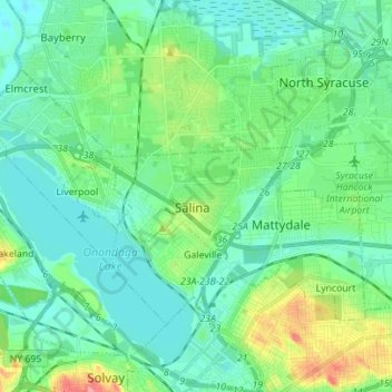
Name: Town of Salina topographic map, elevation, terrain.
Location: Town of Salina, Onondaga County, New York, United States (43.07185 -76.25423 43.13833 -76.11524)
Average elevation: 413 ft
Minimum elevation: 348 ft
Maximum elevation: 623 ft
Other topographic maps
Click on a map to view its topography, its elevation and its terrain.
Pitcher Hill
United States > New York > Onondaga County > Town of Salina > Pitcher Hill
Pitcher Hill, Town of Salina, Onondaga County, New York, 13212-3827, United States
Average elevation: 417 ft