Geolocate

Volga topographic map

Click on the map to display elevation.

About this map

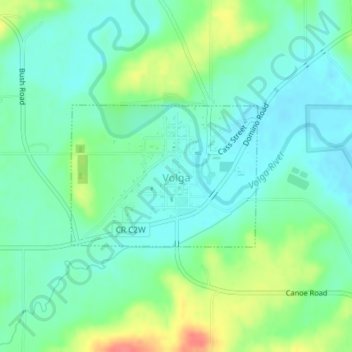
Name: Volga topographic map, elevation, terrain.

Location: Volga, Clayton County, Iowa, United States (42.79754 -91.55211 42.80844 -91.53259)

Average elevation: 837 ft

Minimum elevation: 774 ft

Maximum elevation: 981 ft

Clayton County trails, hiking, mountain biking, running and outdoor activities

Other topographic maps

Click on a map to view its topography, its elevation and its terrain.

Volga River

United States > Iowa > Clayton County

Average elevation: 879 ft

Volga River

United States > Iowa > Clayton County

Average elevation: 879 ft

Volga River

United States > Iowa > Clayton County

Average elevation: 879 ft

Volga River

United States > Iowa > Clayton County

Average elevation: 879 ft

Gear up for your next adventure:

🚗GPS Dash Cams - Record your scenic drives through mountain passes and canyons
🛠️Outdoor Gear Repair Kit - Essential tools to fix gear on the trail
🪶Camp Gear Gift Set - Perfect gift bundle for outdoor fans
🦺Reflective Outdoor Gear - Safety gear for low‑light conditions
📌Outdoor GPS Map App - Apps and devices for digital topographic navigation

As an Amazon Associate, this site earns from qualifying purchases at no extra cost to you.