
Derecik topographic map
Interactive map
Click on the map to display elevation.
About this map
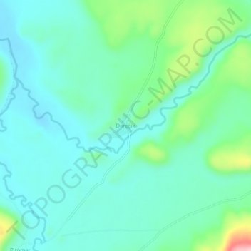
Name: Derecik topographic map, elevation, terrain.
Location: Derecik, Patnos, Ağrı, Eastern Anatolia Region, Türkiye (39.13815 42.99368 39.17815 43.03368)
Average elevation: 5,869 ft
Minimum elevation: 5,705 ft
Maximum elevation: 6,453 ft