
Tamarindo topographic map
Interactive map
Click on the map to display elevation.
About this map
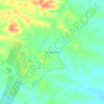
Name: Tamarindo topographic map, elevation, terrain.
Location: Tamarindo, Guayaquil, Guayas, Ecuador (-2.53667 -80.32000 -2.49667 -80.28000)
Average elevation: 128 ft
Minimum elevation: 46 ft
Maximum elevation: 285 ft