
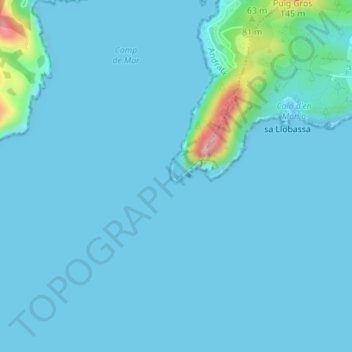
Cap Andritxol topographic map
Interactive map
Click on the map to display elevation.
About this map
Name: Cap Andritxol topographic map, elevation, terrain.
Average elevation: 43 ft
Minimum elevation: 0 ft
Maximum elevation: 571 ft
Other topographic maps
Click on a map to view its topography, its elevation and its terrain.
Cap des Llamp
España (mare territorial) > Islas Baleares > Andrach
Cap des Llamp, Andrach, Sierra de Tramontana, Islas Baleares, 07157, España (mare territorial)
Average elevation: 85 ft