
Ojeon-dong topographic map
Interactive map
Click on the map to display elevation.
About this map
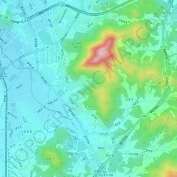
Name: Ojeon-dong topographic map, elevation, terrain.
Location: Ojeon-dong, Uiwang-si, Gyeonggi, South Korea (37.34873 126.96033 37.37330 127.01564)
Average elevation: 335 ft
Minimum elevation: 112 ft
Maximum elevation: 1,188 ft