
Benthall topographic map
Interactive map
Click on the map to display elevation.
About this map
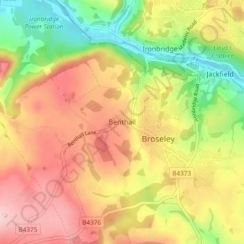
Name: Benthall topographic map, elevation, terrain.
Location: Benthall, Shropshire, England, TF12 5RP, United Kingdom (52.59608 -2.51248 52.63608 -2.47248)
Average elevation: 466 ft
Minimum elevation: 131 ft
Maximum elevation: 758 ft