
Mount Everard topographic map
Interactive map
Click on the map to display elevation.
About this map
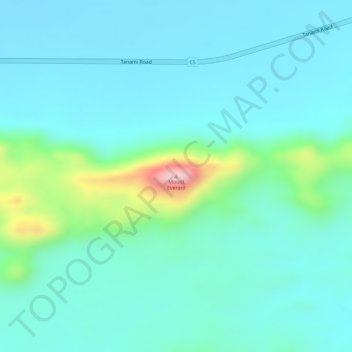
Name: Mount Everard topographic map, elevation, terrain.
Average elevation: 2,520 ft
Minimum elevation: 2,375 ft
Maximum elevation: 3,091 ft
Other topographic maps
Click on a map to view its topography, its elevation and its terrain.
Alice Springs
Australia > Northern Territory > Alice Springs
Alice Springs, Town of Alice Springs, Northern Territory, 0870, Australia
Average elevation: 2,070 ft
Todd River
Australia > Northern Territory > Alice Springs
Todd River, Alice Springs, Town of Alice Springs, Northern Territory, 0870, Australia
Average elevation: 2,073 ft
Heavitree Gap
Australia > Northern Territory > Alice Springs
Heavitree Gap, Alice Springs, Town of Alice Springs, Northern Territory, 0870, Australia
Average elevation: 1,936 ft