
Puerto Pilón topographic map
Interactive map
Click on the map to display elevation.
About this map
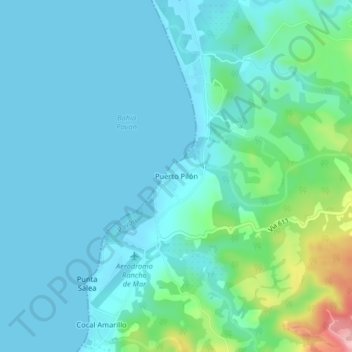
Name: Puerto Pilón topographic map, elevation, terrain.
Average elevation: 98 ft
Minimum elevation: 0 ft
Maximum elevation: 591 ft
Other topographic maps
Click on a map to view its topography, its elevation and its terrain.
Conte
Costa Rica > Cantón Golfito > Pavón > Conte
Conte, Pavón, Cantón Golfito, Provincia Puntarenas, 60704, Costa Rica
Average elevation: 276 ft