
La Castagnade topographic map
Interactive map
Click on the map to display elevation.
About this map
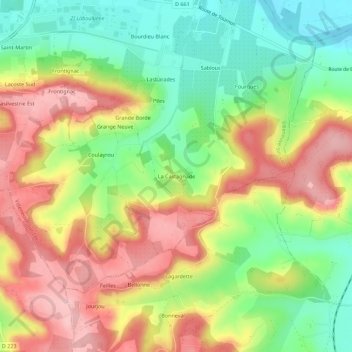
Name: La Castagnade topographic map, elevation, terrain.
Average elevation: 427 ft
Minimum elevation: 171 ft
Maximum elevation: 692 ft
Other topographic maps
Click on a map to view its topography, its elevation and its terrain.
47300
France > Nouvelle-Aquitaine > Lot-et-Garonne > Villeneuve-sur-Lot
47300, Saint-Cyr, Villeneuve-sur-Lot, Lot-et-Garonne, Nouvelle-Aquitaine, France métropolitaine, France
Average elevation: 213 ft
HLM du Pont de Marot
France > Nouvelle-Aquitaine > Lot-et-Garonne > Villeneuve-sur-Lot
HLM du Pont de Marot, Villeneuve-sur-Lot, Lot-et-Garonne, Nouvelle-Aquitaine, France métropolitaine, 47300, France
Average elevation: 249 ft