
山南市 topographic map
Interactive map
Click on the map to display elevation.
About this map
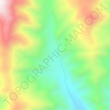
Name: 山南市 topographic map, elevation, terrain.
Average elevation: 15,223 ft
Minimum elevation: 13,960 ft
Maximum elevation: 16,949 ft
Other topographic maps
Click on a map to view its topography, its elevation and its terrain.
打隆镇
Chine > Tibet > ལྷོ་ཁ་ས་ཁུལ། / 山南市 / Shannan > 打隆镇
打隆镇, སྣ་དཀར་རྩེ་རྫོང་ / 浪卡子县 / Nagarzê, ལྷོ་ཁ་ས་ཁུལ། / 山南市 / Shannan, Tibet, Chine
Average elevation: 14,839 ft