
Bueberg topographic map
Interactive map
Click on the map to display elevation.
About this map
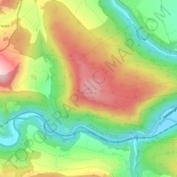
Name: Bueberg topographic map, elevation, terrain.
Location: Bueberg, Laufen, Bezirk Laufen, Basel-Landschaft, 4242, Schweiz (47.40838 7.46637 47.40848 7.46647)
Average elevation: 1,624 ft
Minimum elevation: 1,188 ft
Maximum elevation: 2,165 ft