
Etiler Mahallesi topographic map
Interactive map
Click on the map to display elevation.
About this map
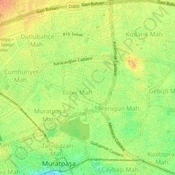
Name: Etiler Mahallesi topographic map, elevation, terrain.
Average elevation: 180 ft
Minimum elevation: 102 ft
Maximum elevation: 236 ft
Other topographic maps
Click on a map to view its topography, its elevation and its terrain.
Lower Duden Waterfall
Turkey > Mediterranean Region > Antalya > Muratpaşa
Lower Duden Waterfall, Antalya, Muratpaşa, Antalya, Mediterranean Region, 07230, Turkey
Average elevation: 82 ft