
Montrose-Ghent topographic map
Interactive map
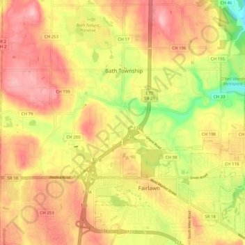
Click on the map to display elevation.
About this map
Name: Montrose-Ghent topographic map, elevation, terrain.
Average elevation: 1,037 ft
Minimum elevation: 745 ft
Maximum elevation: 1,237 ft
Other topographic maps
Click on a map to view its topography, its elevation and its terrain.
Hammond's Corners
United States > Ohio > Summit County > Bath Township
Hammond's Corners, Bath Township, Summit County, Ohio, 44210, United States
Average elevation: 1,093 ft