
Sa'Ole County topographic map
Interactive map
Click on the map to display elevation.
About this map
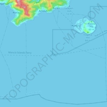
Name: Sa'Ole County topographic map, elevation, terrain.
Average elevation: 26 ft
Minimum elevation: -3 ft
Maximum elevation: 899 ft
Other topographic maps
Click on a map to view its topography, its elevation and its terrain.
Tau Island
United States of America > American Samoa > Si"ufaga
Tau Island, Si"ufaga, Ta'u County, Manu'a District, American Samoa, United States of America
Average elevation: 469 ft