
Рочевичи topographic map
Interactive map
Click on the map to display elevation.
About this map
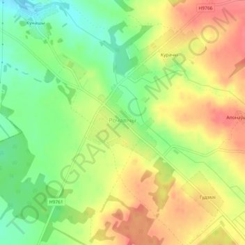
Name: Рочевичи topographic map, elevation, terrain.
Average elevation: 850 ft
Minimum elevation: 735 ft
Maximum elevation: 955 ft
Other topographic maps
Click on a map to view its topography, its elevation and its terrain.
Тисковщина
Беларусь > Минская область > Столбцовский район > Литвенский сельский Совет
Тисковщина, Литвенский сельский Совет, Столбцовский район, Минская область, Беларусь
Average elevation: 945 ft