
Tamins topographic map
Interactive map
Click on the map to display elevation.
About this map
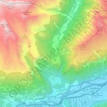
Name: Tamins topographic map, elevation, terrain.
Location: Tamins, Imboden, Grisons, 7015, Suisse (46.82143 9.34158 46.89967 9.45563)
Average elevation: 5,082 ft
Minimum elevation: 1,864 ft
Maximum elevation: 10,144 ft
Other topographic maps
Click on a map to view its topography, its elevation and its terrain.
Hinterrhein
Suisse > Grisons > Imboden > Domat/Ems
Hinterrhein, Domat/Ems, Imboden, Grisons, 7013, Suisse
Average elevation: 2,753 ft