
Lajitas topographic map
Interactive map
Click on the map to display elevation.
About this map
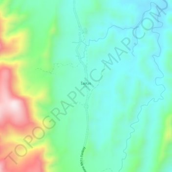
Name: Lajitas topographic map, elevation, terrain.
Location: Lajitas, Provincia Burnet O'Connor, TJA, Bolivia (-21.38792 -64.13768 -21.34792 -64.09768)
Average elevation: 3,235 ft
Minimum elevation: 2,723 ft
Maximum elevation: 4,596 ft