
Monte Lesima topographic map
Interactive map
Click on the map to display elevation.
About this map
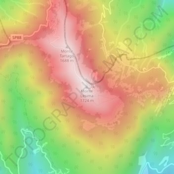
Name: Monte Lesima topographic map, elevation, terrain.
Location: Monte Lesima, Zerba, PC, EMR, Italia (44.67962 9.25955 44.67972 9.25965)
Average elevation: 4,222 ft
Minimum elevation: 2,575 ft
Maximum elevation: 5,584 ft