Les Cours topographic map
Interactive map
Click on the map to display elevation.
About this map
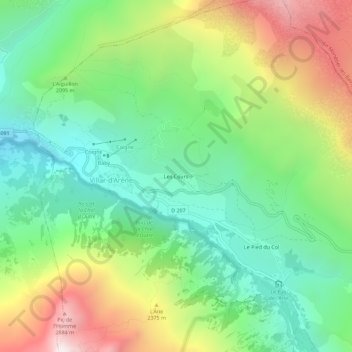
Name: Les Cours topographic map, elevation, terrain.
Average elevation: 6,660 ft
Minimum elevation: 4,843 ft
Maximum elevation: 9,852 ft

Click on the map to display elevation.
Name: Les Cours topographic map, elevation, terrain.
Average elevation: 6,660 ft
Minimum elevation: 4,843 ft
Maximum elevation: 9,852 ft