
Mauna topographic map
Interactive map
Click on the map to display elevation.
About this map
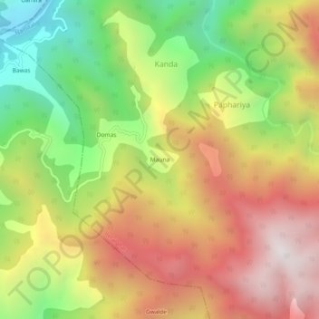
Name: Mauna topographic map, elevation, terrain.
Location: Mauna, Kanda, Betalghat, Nainital, Uttarakhand, India (29.49484 79.23524 29.53484 79.27524)
Average elevation: 4,469 ft
Minimum elevation: 1,998 ft
Maximum elevation: 6,877 ft