
دهستان بهرمان topographic map
Interactive map
Click on the map to display elevation.
About this map
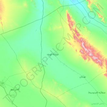
Name: دهستان بهرمان topographic map, elevation, terrain.
Average elevation: 4,800 ft
Minimum elevation: 3,825 ft
Maximum elevation: 9,012 ft
Other topographic maps
Click on a map to view its topography, its elevation and its terrain.
Rafsanjan
Iran > Kerman Province > Rafsanjan County
Rafsanjan, بخش مرکزی, Rafsanjan County, Kerman Province, Iran
Average elevation: 5,049 ft