
Berrahal topographic map
Interactive map
Click on the map to display elevation.
About this map
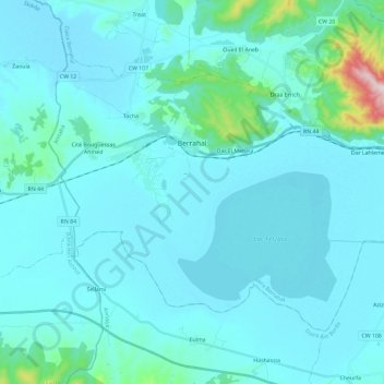
Name: Berrahal topographic map, elevation, terrain.
Location: Berrahal, Daïra Berrahal, Annaba, 23009, Algérie (36.74389 7.37239 36.87853 7.60582)
Average elevation: 151 ft
Minimum elevation: 10 ft
Maximum elevation: 1,726 ft
Other topographic maps
Click on a map to view its topography, its elevation and its terrain.
Oued Ziad
Algérie > Annaba > Daïra Berrahal
Oued Ziad, Oued El Aneb, Daïra Berrahal, Annaba, 23204, Algérie
Average elevation: 259 ft