
Keldağ topographic map
Interactive map
Click on the map to display elevation.
About this map
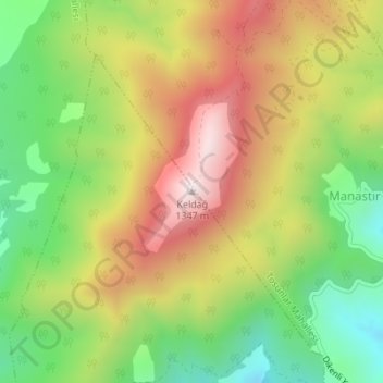
Name: Keldağ topographic map, elevation, terrain.
Location: Keldağ, Ödemiş, Izmir, Aegean Region, Turkey (38.31388 27.88834 38.31398 27.88844)
Average elevation: 3,205 ft
Minimum elevation: 2,064 ft
Maximum elevation: 4,482 ft
Other topographic maps
Click on a map to view its topography, its elevation and its terrain.
Ayvacık Yaylası
Turkey > Ödemiş > Ayvacık Yaylası
Ayvacık Yaylası, Ödemiş, Izmir, Aegean Region, Turkey
Average elevation: 3,051 ft