
Mae Sot topographic map
Interactive map
Click on the map to display elevation.
About this map
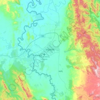
Name: Mae Sot topographic map, elevation, terrain.
Location: Mae Sot, Tak (Provinz), 63110, Thailand (16.55499 98.40955 16.87499 98.72955)
Average elevation: 1,112 ft
Minimum elevation: 558 ft
Maximum elevation: 3,018 ft