
La Fragnée topographic map
Interactive map
Click on the map to display elevation.
About this map
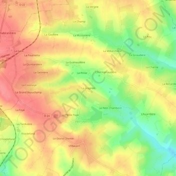
Name: La Fragnée topographic map, elevation, terrain.
Average elevation: 643 ft
Minimum elevation: 495 ft
Maximum elevation: 741 ft
Other topographic maps
Click on a map to view its topography, its elevation and its terrain.
L'Ebaupin
France > Nouvelle-Aquitaine > Deux-Sèvres > Verruyes
L'Ebaupin, Verruyes, Parthenay, Deux-Sèvres, Nouvelle-Aquitaine, Metropolitan France, 79310, France
Average elevation: 633 ft