
Thank you for supporting this site ❤️
Make a donation
Make a donation
Gear up for your next adventure:
As an Amazon Associate, this site earns from qualifying purchases at no extra cost to you.
Loanhead topographic map
Click on the map to display elevation.
Thank you for supporting this site ❤️
Make a donation
Make a donation
Gear up for your next adventure:
As an Amazon Associate, this site earns from qualifying purchases at no extra cost to you.
About this map
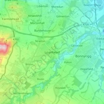
Name: Loanhead topographic map, elevation, terrain.
Location: Loanhead, Midlothian, Scotland, EH20 9RG, United Kingdom (55.83808 -3.18878 55.91808 -3.10878)
Average elevation: 436 ft
Minimum elevation: 125 ft
Maximum elevation: 1,493 ft
Thank you for supporting this site ❤️
Make a donation
Make a donation
Gear up for your next adventure:
As an Amazon Associate, this site earns from qualifying purchases at no extra cost to you.