
Haggen topographic map
Interactive map
Click on the map to display elevation.
About this map
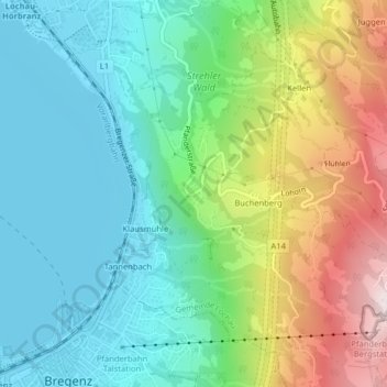
Name: Haggen topographic map, elevation, terrain.
Location: Haggen, Gemeinde Lochau, Bezirk Bregenz, Vorarlberg, Österreich (47.51456 9.75856 47.51674 9.76154)
Average elevation: 1,962 ft
Minimum elevation: 1,289 ft
Maximum elevation: 3,461 ft
Other topographic maps
Click on a map to view its topography, its elevation and its terrain.
Pfänder
Österreich > Vorarlberg > Bezirk Bregenz > Gemeinde Lochau
Pfänder, Gemeinde Lochau, Bezirk Bregenz, Vorarlberg, 6911, Österreich
Average elevation: 2,710 ft