Presa EL Batan topographic map
Interactive map
Click on the map to display elevation.
About this map
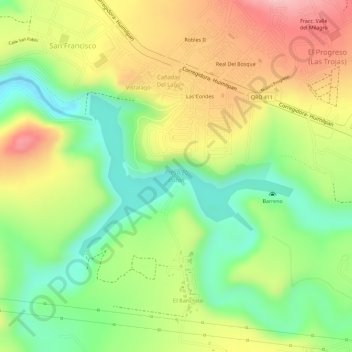
Name: Presa EL Batan topographic map, elevation, terrain.
Average elevation: 6,421 ft
Minimum elevation: 6,148 ft
Maximum elevation: 6,703 ft

Click on the map to display elevation.
Name: Presa EL Batan topographic map, elevation, terrain.
Average elevation: 6,421 ft
Minimum elevation: 6,148 ft
Maximum elevation: 6,703 ft