
Ponnur topographic map
Interactive map
Click on the map to display elevation.
About this map
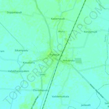
Name: Ponnur topographic map, elevation, terrain.
Location: Ponnur, Guntur, Andhra Pradesh, 522124, India (16.02838 80.51225 16.10838 80.59225)
Average elevation: 23 ft
Minimum elevation: 13 ft
Maximum elevation: 36 ft
Other topographic maps
Click on a map to view its topography, its elevation and its terrain.
Vallabharaopalem
India > Andhra Pradesh > Ponnur
Vallabharaopalem, Ponnur, Guntur, Andhra Pradesh, 522124, India
Average elevation: 20 ft