
Vieille Ville topographic map
Interactive map
Click on the map to display elevation.
About this map
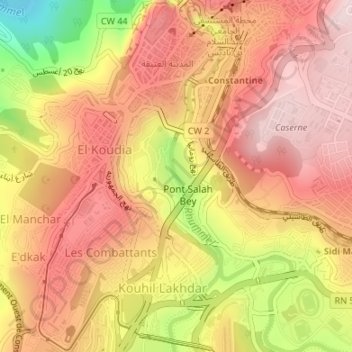
Name: Vieille Ville topographic map, elevation, terrain.
Average elevation: 1,916 ft
Minimum elevation: 1,194 ft
Maximum elevation: 2,310 ft
Other topographic maps
Click on a map to view its topography, its elevation and its terrain.
Constantine
Algérie > Constantine > Constantine
Constantine, Daïra Constantine, Constantine, 25000, Algérie
Average elevation: 2,215 ft