Geolocate

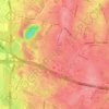
Vienna topographic map

Click on the map to display elevation.

About this map

Name: Vienna topographic map, elevation, terrain.

Location: Vienna, Fairfax County, Virginia, United States (38.87854 -77.28476 38.92182 -77.24109)

Average elevation: 384 ft

Minimum elevation: 249 ft

Maximum elevation: 495 ft

Fairfax County trails, hiking, mountain biking, running and outdoor activities

Other topographic maps

Click on a map to view its topography, its elevation and its terrain.
Difficult Run

United States > Virginia > Fairfax County > Reston

Average elevation: 226 ft

Oak Hill

United States > Virginia > Fairfax County

Average elevation: 364 ft

McLean

United States > Virginia > Fairfax County

Average elevation: 285 ft

George Washington's Mount Vernon

United States > Virginia > Fairfax County > Mount Vernon

Visitors to Mount Vernon now see Washington's study, a room to which in the 18th century only a privileged few were granted entry. This simply furnished room has a combined bathroom, dressing room and office; the room was so private that few contemporary descriptions exist. Its walls are lined with naturally…

Average elevation: 46 ft

McLean

United States > Virginia > Fairfax County

Average elevation: 285 ft

Laurel Hill

United States > Virginia > Fairfax County

Average elevation: 187 ft

Fair Oaks

United States > Virginia > Fairfax County

Average elevation: 430 ft

Woodlawn

United States > Virginia > Fairfax County > Mount Vernon

Average elevation: 46 ft
George Mason

United States > Virginia > Fairfax County

Average elevation: 404 ft

Hutchison

United States > Virginia > Fairfax County

Average elevation: 354 ft

Tyler Park

United States > Virginia > Fairfax County

Average elevation: 335 ft

Lincoln Park

United States > Virginia > Fairfax County > Braddock

Average elevation: 394 ft

Oak Hill

United States > Virginia > Fairfax County

Average elevation: 364 ft

Bryn Mawr

United States > Virginia > Fairfax County

Average elevation: 292 ft

Fairfax Farms

United States > Virginia > Fairfax County > Fair Oaks

Average elevation: 420 ft

Gear up for your next adventure:

🔥Fast-Boil Camping Stoves - Efficient cooking systems for quick trail meals
🧭Hiking Compass - Precision compass for reliable navigation in the wilderness
🔭Stargazing Telescopes - Perfect for camping in low-light pollution areas shown on maps
📻Weather Alert Radios - Stay informed of storm risks while off-the-grid
⛺Backpacking Tents - Weight-optimized shelters for multi-day topographic surveys

As an Amazon Associate, this site earns from qualifying purchases at no extra cost to you.