
Boughriba topographic map
Interactive map
Click on the map to display elevation.
About this map
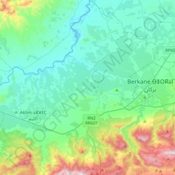
Name: Boughriba topographic map, elevation, terrain.
Average elevation: 801 ft
Minimum elevation: 13 ft
Maximum elevation: 3,747 ft
Other topographic maps
Click on a map to view its topography, its elevation and its terrain.
jbel aklim sghir
Maroc > Cercle d'Aklim > Boughriba
jbel aklim sghir, Boughriba, caïdat de Bni Ourimeche, Cercle d'Aklim, Province de Berkane, Oriental, Maroc
Average elevation: 381 ft