
Platanitos topographic map
Interactive map
Click on the map to display elevation.
About this map
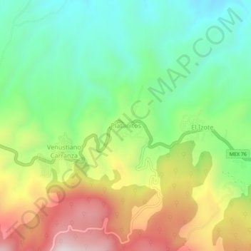
Name: Platanitos topographic map, elevation, terrain.
Location: Platanitos, Municipio de Tepic, Nayarit, 63711, México (21.50266 -104.99510 21.54266 -104.95510)
Average elevation: 3,533 ft
Minimum elevation: 2,566 ft
Maximum elevation: 5,023 ft